If you’ve recently learned about the CIA’s activities in Laos and want to go on an adventure to uncover the past, you’re in the right place. After 2400km, and over a month of motorbike travel on some of the most dangerous, adrenaline-fuelled trails I’ve ever ridden, I managed to visit many of the available sites left over from the Laotian Civil War and the greater Vietnam War. In this article, I’ll share an exact route (interactive map), photos of the locations, which are best, what you need to travel with a motorbike in Laos and whether they’re worth visiting.
Let’s go!
Beware: some of the conditions of these routes are extremely dangerous, and often subject to landslides. Most are dirt tracks, or just slabs of jagged rock for miles. Please proceed with caution, and travel with a partner.
I travelled solo, but I would not recommend you do the same after doing so. I am not responsible for any injury or difficulty you may come across during this trip. It is your ultimate decision to do it or not.
Here’s the full trip in video format if you prefer to watch over reading
Interactive Map of CIA Bases & Other Historical Points of Interest
Here is the interactive map of the route I followed for this trip:
Here are the ex-CIA bases in Laos that are listed online and currently visitable:
- LS85 Phou Pha Thi (ticket required)
- LS36 Nha Khang (no route on Gmaps, but road available, very difficult)
- LS98 Long Tieng (biggest CIA base)
- LS20A Long Tieng
- LS20 Sam Thong (beware of Gmaps road, explained below!)
- LS88 Bouam Louang
- LS2 San Tiau
- LS03 Nong Het
- LS15 Ban Na
- LS26 Xieng Dat
- LS5 Ban Pa Dong
- LS272 Ban Xong-Na Xu
- LS6 Vang Vieng
- LS22 Xieng Khouang
I will go into some of these in more detail below, talking about routes, the danger and difficulty of each, and which roads to completely avoid on Google maps so you can stay *relatively* safe during your travels. I did not travel to all of them, so I will only cover the ones I did travel to under the headings below.
If you want a guide that is less about historical stuff, and more of an overview of Laos, this isn’t it. However, MadOrNomad has a fantastic Laos motorbike itinerary.
Important Route Recommendations & Border Crossings To Avoid Hassle!
Video of border crossing process Thailand to Laos I made
If you are going on this trip, you should start at the tip of the South (or North) and follow the route suggested on the interactive map above. It will take you to old destroyed helicopter crash sites, ex-CIA bases, museums, incredibly remote villages and down some of the most difficult trails you may come across in Asia. Cool eh?
To avoid any difficulties on this route, follow this short guide:
- Start at Chong Mek border in Thailand
- Avoid Stung Treng, Cambodia or Lao Bao border Vietnam (both exceptionally corrupt)
- Follow the interactive map provided in this guide
- Avoid Google maps roads from
- Long Tieng to Sam Thong (very dangerous locals do not use anymore!)
- LS20A (takes you past old hospital, stop there, do not follow into field)
- LS36 Nha Khang requires a GPS map from Laosgpsmapper, please enquire
Company Scam (Laos Side) & Tour Scam (Thailand + Vietnam)

When crossing into Laos by motorbike you will be told that you either need a tour service, or a company service. If you go to Nong Khai border in Thailand or any other for that matter, you will not be allowed to pass without it. At Chong Mek this is not the case, and is the only border, as of current, that allows you to self-drive in Laos.
Beware of Laotian officials asking for a $100 fee to import the bike under their company service. This is also a scam to earn more money. They will tell you regulations have recently changed, this is not the case.
How do I know?
I did it all without a company or a tour on a 125cc (deemed impossible by others).
If you are crossing at Chong Mek border, you will be approached by someone who will try to convince you about needing a company. Please ignore them and proceed to customs, and a small building on the left, where you will find 2 grey machines. You can follow the process here, and fill out your own customs declaration form, costing 60,000 KIP. If you have a 125cc, the vehicle will not be listed, you need to select “custom vehicle” clicking “custom vehicle”.
This is information from when I crossed in 2024 (this may have changed depending on the date you’re reading this).
Can I Take A 125cc into Laos?
Most people will tell you there’s a 250cc limit. This might be written in law, but in practice you can currently take a 125cc into Laos. Make sure you click “custom vehicle” on the customs declaration machines, and you will be able to input your bike and pay for your tax. At other borders, you need a company to do this for you, which is why Chong Mek is the preferred border crossing of choice.
Can I Return To Any Border?
After your customs declaration form is stamped, you can return to any border of your choice. For instance, I returned to Nong Khai border, even though I crossed at Chong Mek. Coming back, no company services were required. You only need to stamp back into Thailand.
Insurance For The Bike
There is optional insurance available at the border. This can be purchased for 500 baht ($14-16 USD), and will cover you for 30-days of travel in Laos.
Temporary Export Permit From Thailand (Motorbike Permit)
You get a 30-day temporary limit to export your bike from Thailand. This should be free, but some borders charge 20-40 baht ($0.6 – $1) If you go over this, you are required to pay 1000 baht/day ($30 USD), with a maximum upper limit fine of 10,000 baht ($300). This can be extended at the border you exited from.
Documentation Needed To Cross Borders


To cross the border with a motorbike from Thailand to Laos, you need:
- Green book of motorcycle with you as the listed owner, or permission from the rental company
- Passport valid 6 months
- Visa ($30 USD cost for Laos)
- Temporary Export Permit (Free from Thai side)
- Temporary Import Permit (60,000 KIP from Laos side)
- Valid driving license (ASEAN or Home Country)
- Any country outside of ASEAN agreement needs an International Driving Permit
What About Motorcycle Rentals?

To rent motorbikes in Laos you will need to be in a city.
I personally recommend renting in Pakse, or Vang Vieng. You will get the cheapest deals here. Luang Prabang is incredibly overpriced and does not offer much discount for long-term rentals.
If you rent, you will have to return the bike to the original rental place, so plan your route accordingly.
In Luang Prabang, you’ll be asked for $10-15/day for a Honda Wave, whereas you’ll get the same Honda Wave (probably in better condition) in Vang Vieng for $5-10/day. I got mine on a previous trip for 130,000 KIP ($7/day).
Make sure you get a Honda Wave semi-auto, or Honda Win/Detech. Parts are readily available and it’s and most issues are extremely cheap to fix at garages. Honda Waves can pretty much go anywhere, and the locals take them down roads that will leave your jaw dropped. However, please be careful in rainy season, they’re usually not equipped with the correct tyres to off-road. You can do it, just be extra cautious!
Here are some tips you need to know before renting a motorcycle in Laos:
- Get a semi-auto or manual, it’s better for the mountainous roads you’ll encounter (see below they’re really bad)
- Honda Wave, Win or Detech are best
- Parts are very available and cheap fixes
- Police rarely stop you and if they do you can pay a fine and continue on (although we don’t recommend driving without proper licensing)
- Vang Vieng is cheaper than anywhere else, so get the bullet train there
- In an accident, you cannot leave the country until damages are paid to the other parties
- Don’t admit guilt or your insurance will not cover
- Don’t move the motorcycle either, as this is considered an admission of guilt in Laos
- Avoid driving in the rainy season as roads can get really bad
- For long rentals you can barter the price down, but it might be cheaper to purchase a motorcycle and sell at the end of your trip
The Lao Historical Itinerary
We got all the beauracracy out of the way… PHEW! Now for the fun!


In this section I’ll list all of the places I would recommend adding to your itnerary in Laos.
I will write this as if you are following the journey from Pakse. I didn’t really see anything in Pakse, so I can’t comment, but there are great war-themed cafes and museums you can check out from what I have heard. There are also the famous, incredible waterfalls. In general, Pakse is a great place to chill for a few days and ride around, and it is absolutely stunning… anything more than that, I have no idea and I’m not going to pretend I do. This article is about following secret war trails, not eating Belgian waffles by the river (although I did eat some great Honey Toast in Savannakhet).
I would recommend checking out:
- Wat Phousalao (Huge golden buddha on mountain)
- 1971 cafe (old electricity office left in ruin from bombing)
- Tad Gneuang Waterfall (big touristy waterfall)
Bombed Bridges
This is a video I made containing the adventure to, and all locations for Bombed Bridges, Downed Helicopters, Xepon, Lam Son 719 Operation, Savvanakhet and Vietnam War Shelter:
Starting out from Pakse, this is the first stop on your long journey! Now, this is a bit of an ominous title, and there are loads of bombed bridges throughout Laos, but these ones are particularly cool, they’re on route to Xepon, and they give you a nice introduction to what trail roads might be like later in your journey. This bridge collapsed during the civil war due to the heavy 270 million bomb, bombing campaign unleashed on Laos.
You can either turn back around here and take a paved road, or you can venture into oblivion and take the gnarly off-road routes on the other side.
To get across, you get to feel like Indiana Jones uncovering unchartered territory, and take a ferry across the other side, which will set you back the grand sum of 25,000-50,000 kip ($1-3).
They may try to rip you off. I’ve heard people get charged anywhere between 100-150k kip. If they ask you that, barter but if they don’t budge you really have no other options to get past.


Road Difficulty To & From Bombed Bridges
Getting to the Bombed bridges is fairly easy. There is a little section of dirt road that could prove difficult for some riders. If, however, you cross to the other side, expect medium difficulty trails. If you are new to trail riding, please proceed with caution. I was new to trail riding and was ok, but I do also have 1 year’s experience already riding a motorbike. Please take into account your skill level before crossing.
The estimate Google Maps gives you is not correct. It told me 2 hours, but it took a total of 4. If you are more experienced you can likely do it in less.
I would recommend travelling with a friend and avoid rainy season.
New Xepon & Old Xepon
Next on the list will be Xepon. You can likely make the Bombed Bridges and Xepon in one day if you set off early, so set off early!
Xepon is where one of the largest battles code-named Operation Lam Son took place, in an American attempt to dismantle the Ho Chi Minh trail. Over 100 helicopters were lost in this mission alone, and an entire village was displaced from the bombing, which is the reason there are both New and Old Xepon markers on the map. Additionally this mission is where South Vietnamese War Hero Tran Ngoc Hue was captured, after holding out his position for so long he and his platoon drank their own urine to sustain themselves. Shortly after they were overrun and he subsequently spent 18 years in re-education camps.
Anyway, you get the picture… very cool place!
Here you’ll likely run into Halo or MAG employees who are currently dealing with the unexploded ordinance from the war, and it is where their HQ is located in Laos.
I would recommend talking to some of them if they are not busy and you get the chance, I got some absolutely brilliant recommendations on spots to visit from a simple 5 minute conversation in a shop.


Things to see in Xepon:
- Old Xepon village (displaced by bombing)
- North and South Temples (scars from schrapnel can be seen)
- Lam Son 719 War Museum (close to Xepon) 50,000 kip ($2-3 USD)
- Halo Trust Lao PDR (you can’t go in but cool nonetheless)
Staying in Xepon & Interactive Map
I wouldn’t recommend staying here, you could easily get here in a day, see all of the things you want to see and get to Savannakhet where you will find better hotels, restaurants etc. If you have to stay, there are Guesthouses, a local mini mart, bakers (the bakers is pretty good) and restaurants.
You can stay in the Guesthouses for 100,000-250,000 kip ($5-15).
Important note: the Lao Bao Vietnam border is close, so you could make a day trip to Khe Sanh and the DMZ in Vietnam as well, which would supplement this trip perfectly!
Road Difficulty in Xepon
Roads are quite tame here compared to the rest of Laos. I would say a beginner could ride these. However, if you are following the route to the famous bombed bridges, and getting the ferry across the river (seen above), then you will encounter trails that are pretty difficult. Be careful if you are not an experienced rider.
Savannakhet (Old Air America Airstrip, Now Functioning Airport)
Although there’s not too much here in terms of the war, Savannakhet is a great place to stop for a few days for some rest (if needed). Nice hotels, restaurants, supermarkets and everything you will need. There are also some great spots like the Dinosaur museum, and but you can go inside and look around the airport, where US military would have used C130s to transport soldiers and goods to and from bases under the secret, clandestine airline, Air America.
Air America additionally turned a blind eye to the huge opium trade in Laos, and many of the old planes used would’ve helped Ethnic Hmong to transport opium from village to village.
Savannakhet is also the first landing spot of the CIA’s secret agent who spearheaded the entire secret war in Laos – Bill Lair. Landing in 1959, just 8 years after he arrived in Thailand, he would help to create relations with the Hmong tribe who were trained to fight the Pathet Lao. Later, the war expanded from a barebones operation into something much larger than he could have ever imagined (you’ll see the huge Thai CIA HQ below… it’s massive).
Xe Bang Fai Cave


Xe Bang Fai Cave is a huge 2km long cave that is absolutely stunning. It was also used by locals as a shelter during the heavy bombing raids during the Laotian Civil war. You can trek down to the river in all seasons, however if you would like a boat ride inside the cave, you MUST go before rainy season begins.
There is only 1 Guesthouse that is nearby (Chansamai Guesthouse) and there is nothing else to see in the area, so I have not provided an interactive map for this section. The Guesthouse is pretty awful, but it’s only 150k kip for the night. Expect mouldy walls and cobwebs.
Road Difficulty to Xe Bang Fai Caves


The roads here are very difficult, they are long and full of muddy sections, rivers you’ll have to cross etc. they will take far longer than Google maps suggests. Please set out early from where you are setting out from. The pictures do not do the difficulty justice.
They are some of the most beautiful roads I’ve driven too.
Lak Sao and Pakxan


These are stopovers, and great rides. There are a few monuments and other points of interest like waterfalls on the way. It’s part of the Thakek loop which is fairly uninspiring compared to the trail roads you might have already been on, and the trails to come. However, you will be blessed with great, paved roads and nice views with stock up points every couple of kms. So rejoice in your well earned break!
In Lak Sao I highly recommend staying in Meesouk Guesthouse (I will upload a video of it soon, if not you can see it in the YT video), it is by far the cleanest and most beautiful Guesthouse in the entire area. It’s 250,000 kip which is a little pricey compared to others, but it is well worth it. The rooms are very new, it’s very clean and the location is breathtaking.
In Pakxan there’s a pretty cool monument, but not much else. This is another stopover town. After this you will head for LS22 Xieng Khouang.
LS22 Xieng Khouang
Video I created making my way to LS22 Xieng Khouang:
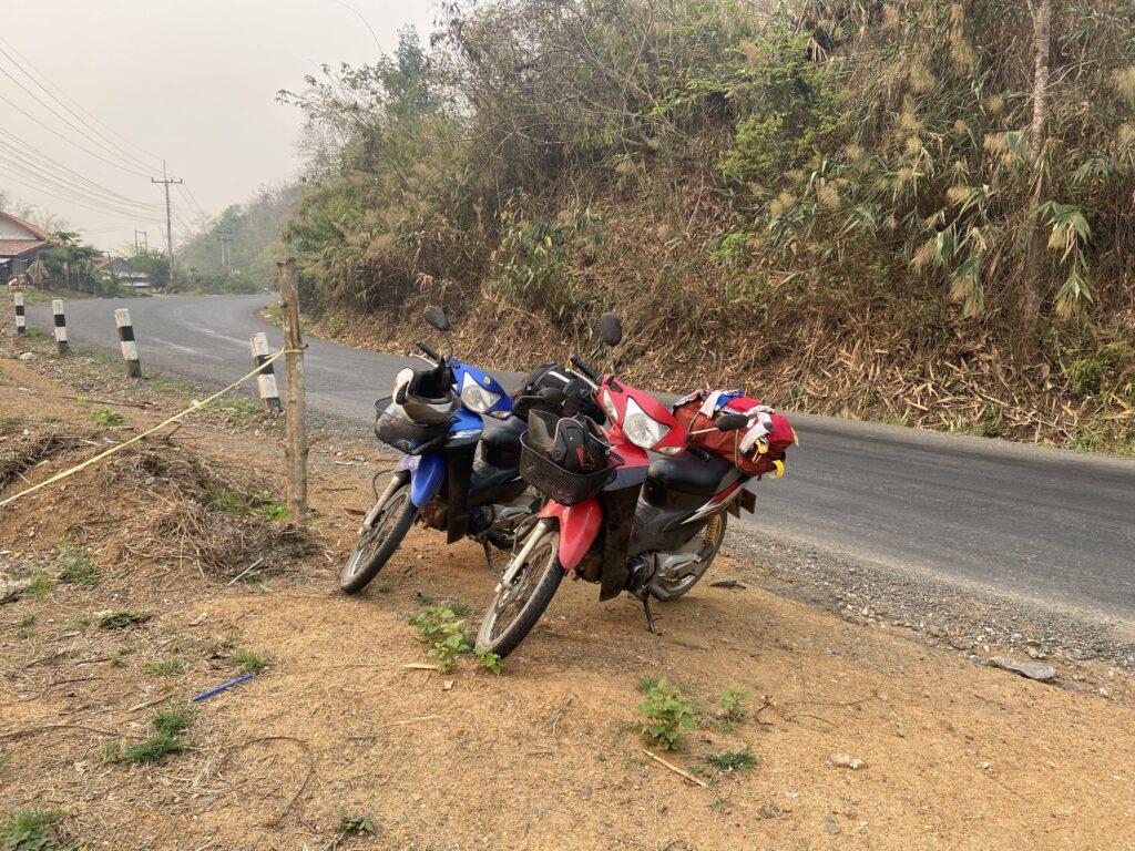
This base is located somewhere deep on remote trails and has some of the most difficult routes in Laos. Unfortunately due to the sands of time, nothing remains of the base. However the adventure is completely worth it, and on the route you will get to pass Hmong villages, where many Hmong may have been recruited for the secret army during wartime. This is some of the most remote driving I did in Laos, with nothing for miles and incredibly untouched villages.
However, despite the beauty and adventure, it must be said that – these trails are for the advanced rider
Please take this into account before going, make sure you have enough food and water to last you 2 days, in 30+ degree heat and humidity. Locals are extremely friendly when you run into them, but for miles you will not see anyone.
When leaving Pakxan, it will be around 20km to the first village (it is not on Google maps). Please stop here, stock up on lots of supplies before carrying on, after this you will not encounter anyone for 40-60kms on very difficult trail roads (this could be hours in those conditions – see video).
Additonally a lot of the routes on Google maps are wrong down this road. Please stop and ask at the first village for help. There is a man who speaks decent enough English to help direct you, as some roads will have been blocked off due to landslides or been changed over time due to rain washing them away.
There are no Guesthouses on this route, and you will need to reach Muang Hom to find anywhere to sleep. If you can camp, it is possible, but during rainy season be very careful of where you pitch. I had to camp overnight, and a very friendly local took me in, letting me camp in his front garden and cooked me some traditional Hmong food!
Below are a few shots of the trail. I didn’t get much chance to take more as time was running out, and I was low on supplies. If you want to see more, check the video.


Important note: On the way there is also a small turn off to a village that is not on Google Maps. This is the original village of the man who came to rule Laos upon it’s liberation – Tan Kayasone Phomivane. The name of the village is Nampakhain (look out for it, it will be a turn off to the right).
Long Tieng (The Most “Secret” Place on Earth) LS98
Video on Long Tieng motorbike travel and history I made:
This is a fantastic site that is 100% worth visiting. People are exceptionally friendly, but their English skills are diminished. Fortunately, if you can speak a bit of Thai, people are very open to sharing the horrors of the war and what they experienced during the battles.
One lady spoke to me about the UXO problems from the leftover from the 270 million bombs unleashed on Laos. A lot of this bombing focussed on major battles such as the battle for Skyline Ridge in Long Tieng, and the Plain of Jars (close to Long Tieng and explained below). She told me that a lot of farmers will be tending to new grounds and die after hitting the UXO hidden in the ground.
Long Tieng was an ex-CIA base that was once home to 40,000 inhabitants during the Civil War and was the biggest base that the CIA built in Laos. It was so busy, that planes took off and landed every 2 minutes. This base would be where the CIA would train the tribe of Hmong to fight a guerilla war against the Pathet Lao (communist Laos).
One of the most notable battles here was Skyline Ridge, where 3 assaults and 25-30,000 men were sent by North Vietnam to attempt to take the ridge, from Hmong and Thai fighters. Each of these assaults ultimately failed to gain control of the war’s most “secret” base, and Long Tieng was never taken. However, in February 1975, evacuations of the base began as Pathet Lao and PAVN troops began to advance and control more parts of the country.


At Long Tieng you can see:
- Vang Pao’s Headquarters (the Hmong leader)
- The old airstrip used for Air America planes, C130s and bombing runs
- The old decaying hospital used to treat casualties
- An old cinema used for entertainment
- The Lao King’s final residence
For more information on Long Tieng, please check out Frazer and Yoyo’s work (from Yoyo Sauce) which does a deeper dive on Long Tieng specifically.
Staying In Long Tieng & Points of Interest (Interactive Map)
There are no fancy hotels here, so do not expect luxury. You can find Guesthouses for 100,000-200,000 kip/night.
I would recommend staying at Long Cheng View Guesthouse. It’s clean, has running water, air con, and everything you need for a good sleep but is quite basic. The owners are absolutely wonderful people, they invited me for breakfast there, shared tea with me and gave me advice on my routes out of Long Tieng (explained below)
Road Difficulty To Long Tieng
The roads in and out of Long Tieng are not very well maintained and a lot are currently being built. There are a few trails you will have to pass, and I would consider these to be a medium difficulty, based on the roads that I have personally been on in Laos. They are pretty dangerous if you’re a new rider and have never done trails before, but compared to some of the roads you will encounter in Laos, they’re are by no means the worst.
However, riding in Laos is like riding on extreme difficulty, so please proceed with caution.
Important note: beware leaving Long Tieng to Phonsavan or Sam Thong. The road Google Maps provides is an old road built during wartime, that no one uses anymore. It is exceptionally dangerous, especially in rainy season. Follow the big road, and ignore the turn off to the left (it’s a tiny rock road, you’ll know when to ignore when you see it). Follow the big road you’ll already be on, Google maps will tell you this is the wrong way. It isn’t. Follow this road and you will arrive at Phonsavan.
Sam Thong LS20
After visiting Long Tieng, Sam Thong is the next item on the list. This is an old USAID base, which would be used as a refugee camp for people displaced and homeless from the war. It was additionally used to evacuate Hmong civilians during the relentless bombing and fighting for Skyline Ridge (mentioned above).
This is a great little stop on your way out of Long Tieng and towards Phonsavan where the Plain of Jars can be found. There is not much to see here, and a lot of the historical buildings are gone. However, it’s a pretty interesting place to stop to get an insight into how Hmong villager life is. People are very friendly and are welcoming to tourists.
Phonsavan, Plain of Jars Sites
A video I made documenting the journey from Long Tieng to Phonsavan, Sam Nuea and finishing the trip.
The Plain of Jars are an ancient megalithic site of what are supposed to be burial tombs. There are 3 sites you can visit, but the most interesting is the Plain of Jars Site 1. The others can honestly be missed, but if you want to adventure… why not?
There are huge bomb craters all around the Plain of Jars sites, as they were a strategic point of interest during the civil war and fought over fiercely. Royal Lao Government forces, Hmong and supplementing Thai forces would fight Pathet Lao and North Vietnamese troops to maintain control of this region. Of the 150,000 inhabitants that lived here, all but 9,000 were either killed, wounded, or forced to flee the area by the end of the war.
In Phonsavan you can see:
- Plain of Jars Site 1 (best), 2 & 3
- Huge bomb craters & prohibited sites due to mass bombing campaign
- MAG UXO Visitor centre
- Lao War memorial
- Hmong markets
- Huge Hmong festival (December 30th -Jan 1st)
- A decaying Soviet Tank
- Old Soviet Union settlement

Staying In Long Tieng & Points of Interest (Interactive Map)
Road Difficulty To & From Phonsavan
The roads are very long, and you will spend a lot of time on off-road trails here. Often people during rainy season get rained in at Phonsavan and travel plans are delayed because of the poor conditions. However, in terms of difficulty I rate these roads as medium compared with what I have personally ridden in Laos. They are very hard, there’s lots of landslides and mud baths, but not necessarily advanced.
The road to Phonsavan is long, just make sure you set out early and with plenty of supplies. The road out of Phonsavan is pretty decent.


Some pictures of the roads to Phonsavan. Incredible, breathtaking views on this route, and a village that is like entering the LOTR trilogy.
Sam Nuea – LS85 Phou Pha Thi & Secret Communist City Hidden in The Caves


Sam Nuea is unmissable. In my opinion, this is one of the most amazing places to visit in Laos. It is not my #1 pick, but it is a close 2nd.
On the East, in Vieng Xai you will find the original, communist headquarters of the entire Pathet Lao operation, which was hidden in caves to avoid bomb raids, and avoid being seen by recon planes. Inhabitants would farm under the cover of darkness so they wouldn’t be spotted, and there were huge networks of rooms used to plan offensives and hold meetings between generals, leaders etc.
Just 15 miles away, tucked neatly into the mountains, lies a secret CIA base used for radar to support bombing mission in Laos, and a base that was supplied by a huge airfield built nearby (we’ll learn about below). Being this close to the border of Vietnam and next to the entire communist HQ operations, this was a top-secret base in Laos. Americans stationed here during the war, were ‘civilians’ who had been selected from the USAF, because legally, the US could not have any troops stationed in Laos.
In 1968 it was overrun, killing almost all technicians who were based here.
In Sam Nuea you can see:
- Secret communist cave city Vieng Xai
- HQ
- President’s quarters
- Meeting rooms etc.
- LS85 Phou Pha Thi
- Downed helicopter
- Old Artillery placement
- Machine guns
Staying In Long Tieng & Points of Interest (Interactive Map)
You’ll find everything you need here. I recommend staying in Sam Nuea City and using it as a base to drop your stuff, then venture out to the caves an Phou Pha Thi. Phou Pha Thi mountain gets fairly difficult to ride up towards the end. You will also find some interesting Hmong villages on your way up, with restaurants and shops. When you get to Phou Pha Thi you have to be taken by a guide, sign your name in and pay for a ticket. It is the only base that requires a ticket.
Road Difficulty To & From Sam Nuea
The roads are pretty good here, but mounting Phou Pha Thi, you need to be careful. You will have nice asphalt road most of the way to the top, but to mount the final few hundred metres, you will need to pass mud, gravel and extremely steep, rocky roads. I would rate these as medium difficulty. Be careful coming down the mountain.
Once you get to the top, you can pay for your ticket and walk up the “Stairway to Heaven”.
Muang Hiam LS36 Nha Khang
By far my favourite base in the entire trip. There is no road to it on Google Maps, so you will have to ask for directions or source a 3rd party GPS map. I was able to retreive one from LaosGPSMapper. Please enquire if you want to get the route. I would not follow the road without it, as they are extremely dangerous.
Here you’ll find a huge, almost untouched village, and a massive airstrip that was used to supply base all around the country, including LS85 Phou Pha Thi. On the site you can see the old Kerosine barrels used for fuelling the aircraft, old, rusting tanks, tractors and artillery pieces. There are also some rusting Harleys deep in the jungle I could not personally find myself.
If you have issues, ask the locals, they are incredibly friendly and often will help.
Unforuntately I don’t have many pictures of this site, I had about 30 minutes to leave before daylight went, and you DO NOT want to be on those roads in the dark. If you would like to see the base, please see the end of the YouTube video I embedded above.
Vang Vieng LS6


If you are heading back to Thailand you will head this way. I would thoroughly recommend stopping by Vang Vieng for a rest after your adventure. The base here is just an airstrip with some markets and restaurants along the side of it now, and is unimpressive. However, despite the reputation Vang Vieng has with sleazy stuff, it is an incredibly beautiful town with a lot of fantastic hiking activities available, breathtaking viewpoints and a lot of other tourists to do activities with.
There are fantastic restaurants, bakeries, lots of supermarkets, and everything you’d possibly need. Also, the all lagoons apart from Blue Lagoon 3 are pretty fantastic and untouched. I would highly recommend Blue Lagoon 1, and the caves nearby they are fascinating.
BONUS! Udon Thani – Ramasun CIA Camp


The CIA camp that ran the entire operation in Laos is situated here. There is a vast radar system installed, an underground tunnel you can walk through, and decaying old buildings with leftover equipment such as tanks and aircraft. It has also been rumoured that it was a previous CIA blacksite that had been used to interrogate prisoners during the CIA’s involvement in Afghanistan and the war on terror.
I would highly recommend finishing your trip here. It neatly ties everything together and you get to see just how big the secret war in Laos became by the end of it in 1975 and just how much money was poured into the American fear that communism would take over the world.
I’m not going to provide an interactive map here, the roads are fine, and Ramasun is very easy to find on Google maps.
If you would like to dive even further into the history, when crossing the border at Nong Khai, you can find the old Technical College. This used to be the grounds of one of the biggest refugee camps, that would help support the 3 million+ who fled Laos, Cambodia, and Vietnam combined after the communists won the war.
I did a separate video on that here if you’re interested at all.
Thanks for reading this far! If you enjoyed, share it with a friend. If you didn’t leave a comment below about what I could improve!
I’m Harry – and I was tired of the same old “10 best places I’ve never been but I’m writing about for some reason” blog posts. So… I’m a young traveller on a mission to travel the world and share my true, unfiltered experience, including all the gristly details. From packing my life into one bag for a year, to traveling Vietnam by motorbike, to sorting out Visas for specific countries – I’ve done it all, am doing it all and only give my advice on things I have done – not regurgitated cr*p from another source *cough* most publications *cough*. So bear with us! This project will take some time to grow, and will take a fair bit of money. But I’m determined to make it the single best source of information about traveling on the internet.